YOLO: A FUSION APPROACH TO GEOLOCATING NATURAL RESOURCES
Advancing near real-time AI and drone technology to improve wildlife monitoring and conservation in hard-to-reach landscapes.
The Use of Drones in Wildlife Research

Wildlife rely on remote areas to complete important parts of their life history, such as nesting, raising young, and finding food and shelter. Secluded or inaccessible habitat can challenge our ability to monitor, study and conserve these species. Uncrewed Aerial Systems (UAS, also commonly referred to as drones) have, in recent years, become an important tool for wildlife researchers to better monitor species and understand their ecology . Drones have been used to count populations, assess habitats, collect morphometric and behavioral data, and assess breeding status on taxa including marine and terrestrial mammals , reptiles , birds , and more.
Surveys conducted by UAS have several advantages over traditional survey methods that have made them an appealing alternative for wildlife researchers. Drones are highly versatile in their configuration and payload meaning that many different types of data can be collected, including photos, videos, thermal images, hyperspectral images, and LiDAR data . Additionally, flights and data collection protocols can be preprogrammed using high resolution GPS data to fly preplanned routes with little or no input from the drone pilot . Comparisons between survey methods have shown that the data collected with drones are often more accurate, precise, and efficient that data collected using traditional survey methods . This versatility in data collection and route planning, along with the quality of data, has allowed for a boom of UAS technology use in studies, taxa, and systems .
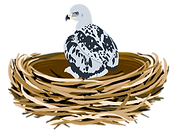
This is particularly the case for environments in systems that are hard to access, difficult or expensive to survey, or where traditional methods are potentially hazardous to researchers, study species, or ecosystems. One example of this is observations of cliff-nesting raptors such as eagles and falcons. The UAS ability to survey large areas regardless of terrain, get closer to the nest without requiring human entry, and collect large amounts of data in a time efficient manner has led to increased interest of the viability of these survey methods .
This project was conceived with the goal of streamlining the data collection and processing of cliff-nesting raptors species, specifically Golden Eagles, and comparing the efficacy and efficiency of these emerging methods to traditional field-based surveys.
Example UAS Mission Plan for Vertical Cliff Scan